
LIDAR scanning, point clouds and BIM for digital twins
LIDAR surveys, point cloud processing and BIM models for digital twins.
What we do
LIDAR scanning of existing facilities: rooms, sheds, hatcheries, processing plants and civil works.
Point cloud processing: registration, cleaning, segmentation and processing in CloudCompare, delivered as light, sector-organised clouds.
BIM modelling in Revit over the point cloud, with coordinated hydraulic and plumbing networks, equipment, structure and architecture.
Digital twins: the as-built BIM model, with data for every item of equipment and network, becomes the basis for operation, maintenance and future expansions. We also deliver IFC models and on-site augmented reality.
When you need it
- When a facility must be modified and there are no reliable drawings.
- When several disciplines share tight spaces.
- When the owner wants a digital twin to operate the facility and plan expansions.
Software and standards
LIDAR scanner, CloudCompare, Revit, Navisworks and IFC.
Typical deliverables
- Registered, processed point cloud
- As-built Revit and IFC model
- Drawings generated from the model
- Clash detection
- Digital twin with equipment and network data
Try a model
Frequently asked questions
What is a digital twin?
A 3D model of a facility as it is actually built, carrying data for its equipment and networks. It supports maintenance and expansion planning without relying on outdated drawings.
LIDAR scanning, point clouds and BIM
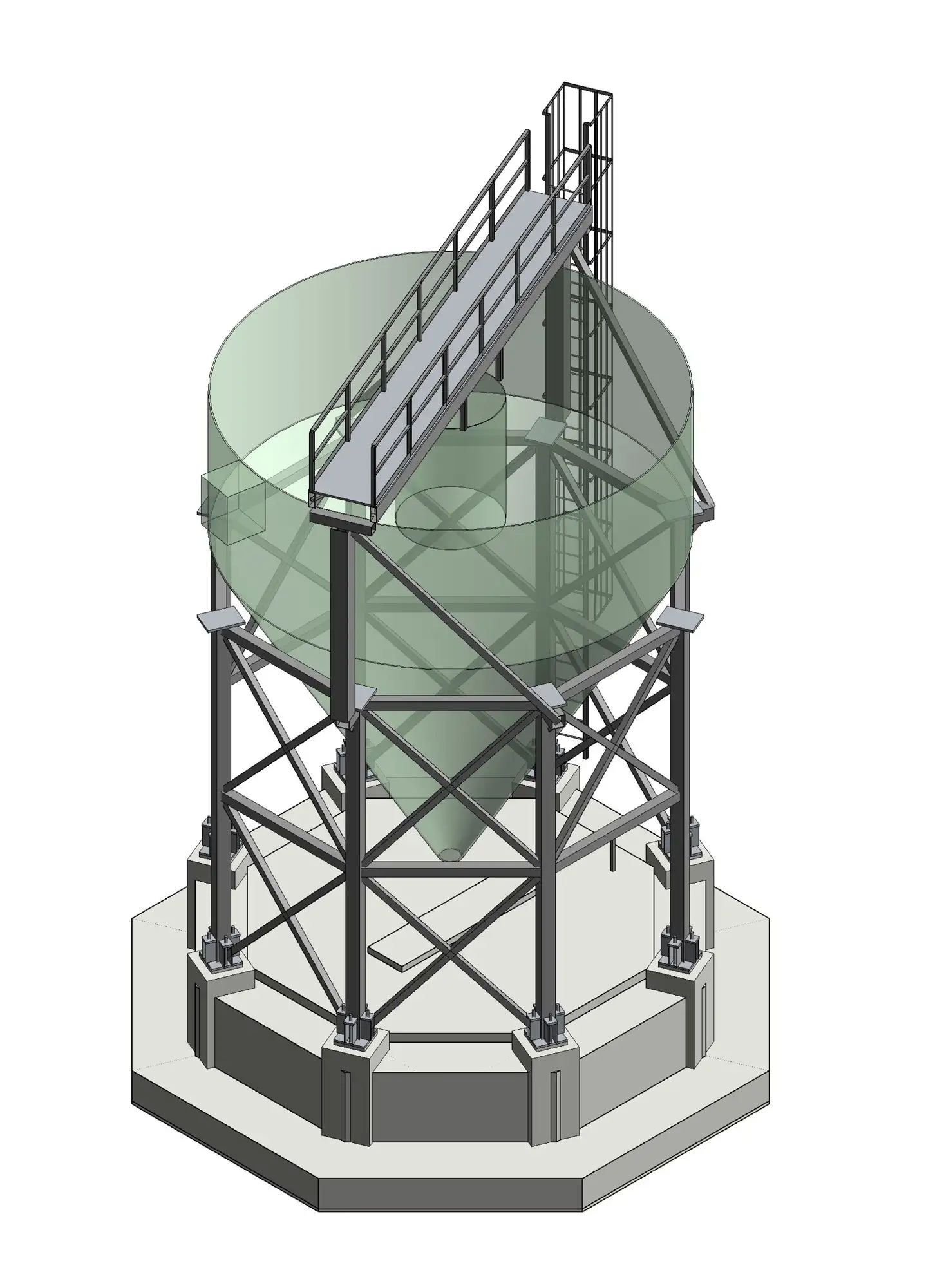
Sludge treatment plant, Caliboro hatchery
Steel structure, foundations and construction drawings for a sludge treatment plant, modelled in Revit inside an operating hatchery.
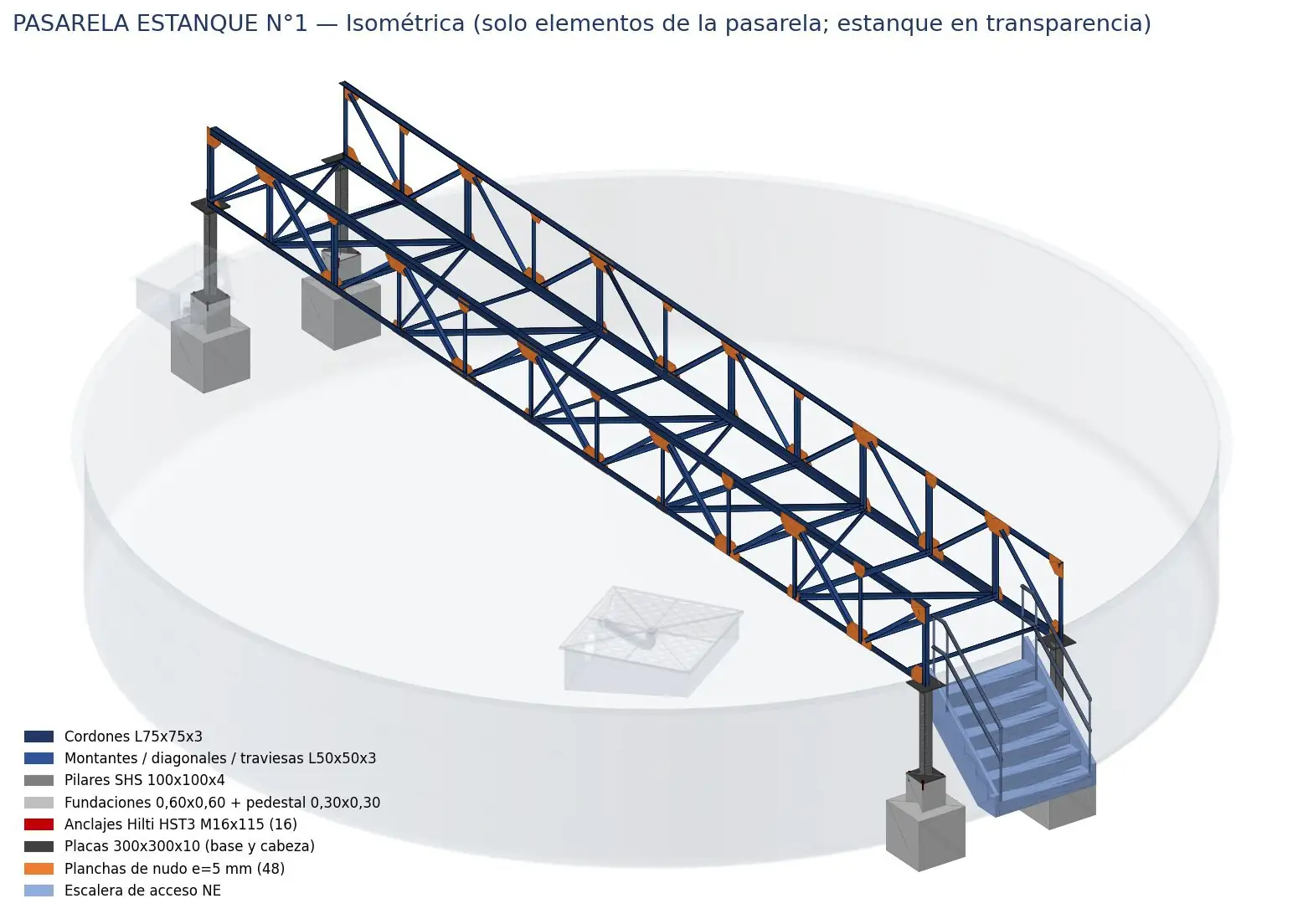
Walkway and hydraulics for Ø12 m fish tanks
Complete tank hydraulics and a steel walkway for new culture tanks, coordinated in an IFC model.
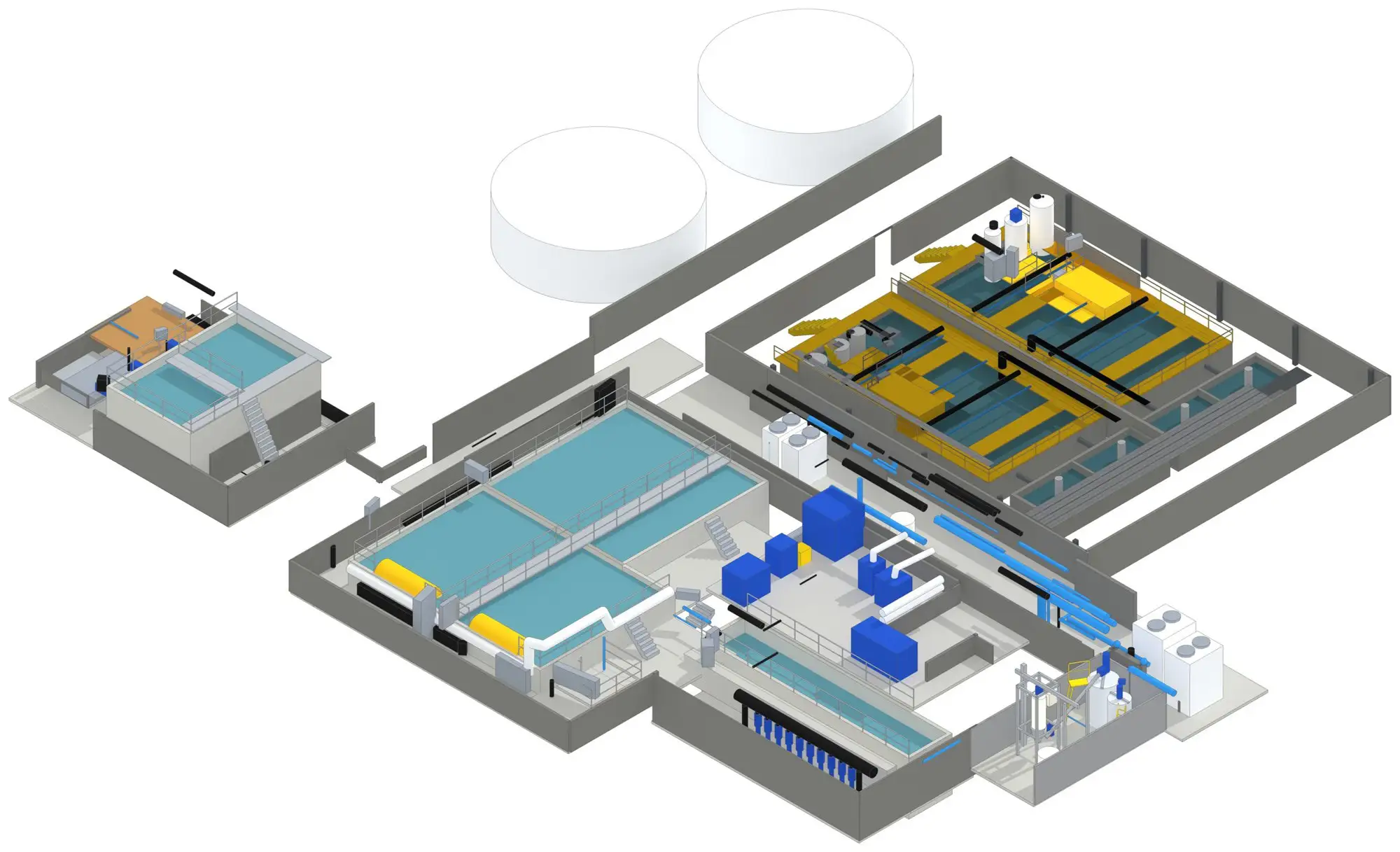
Lime dosing system with LIDAR and BIM
From LIDAR point cloud to a BIM model of each room, designing on the as-built reality.
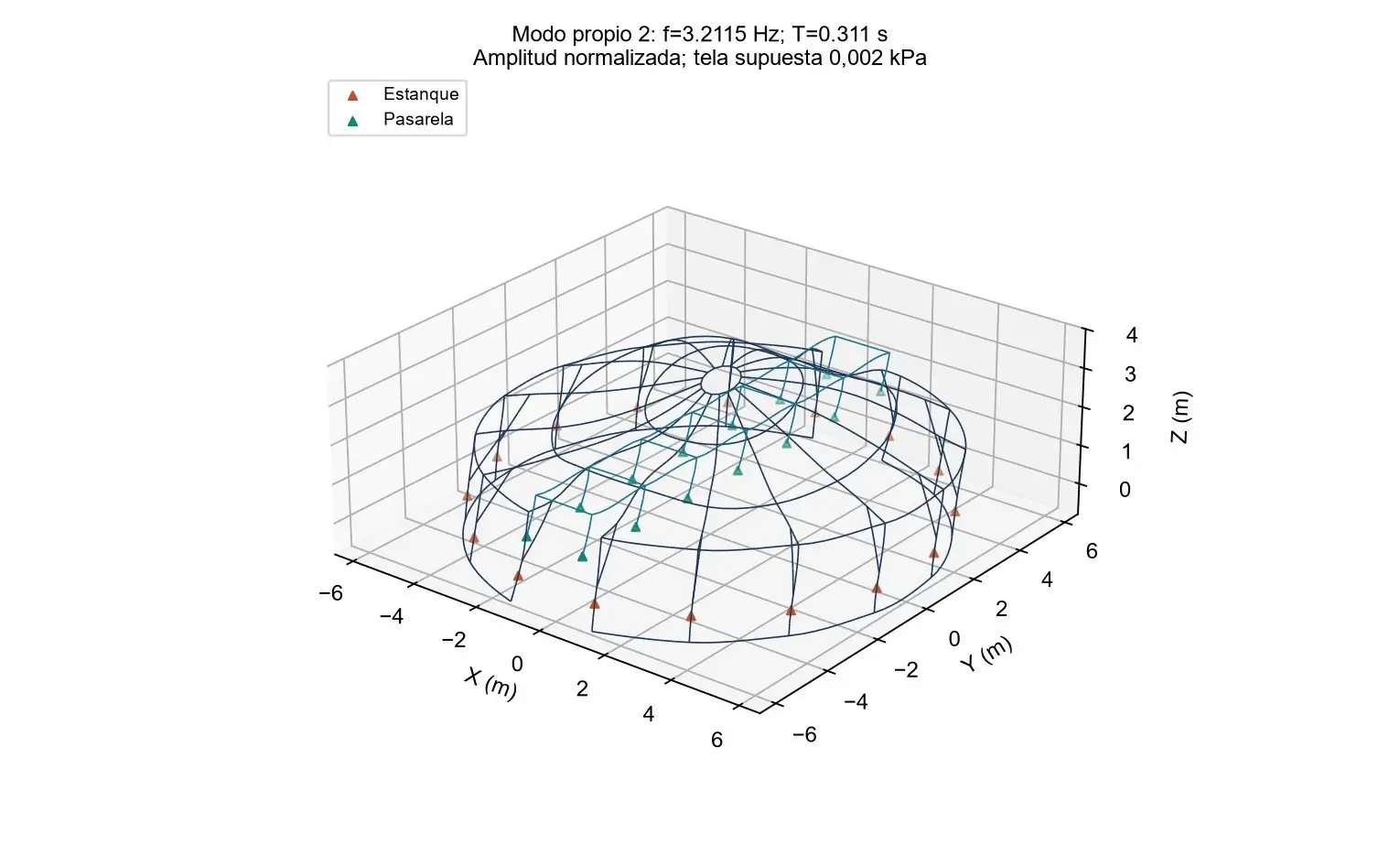
Steel roof for a circular tank
Structural check of a lightweight tubular roof over a fish tank.
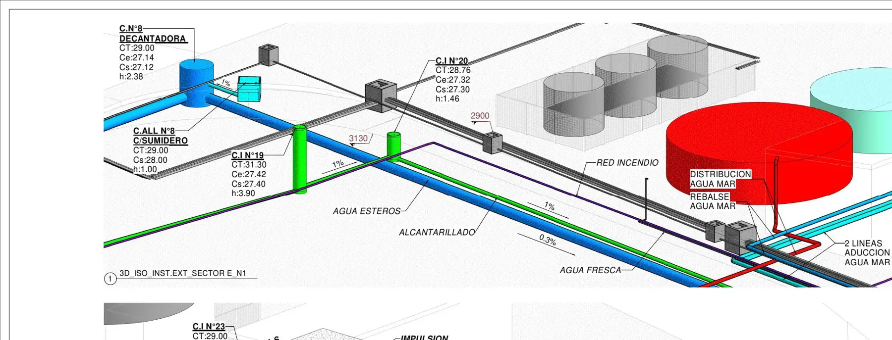
BIM model of external networks and sludge clarifier
BIM coordination of a RAS hatchery’s external networks and design of its sludge clarifier.
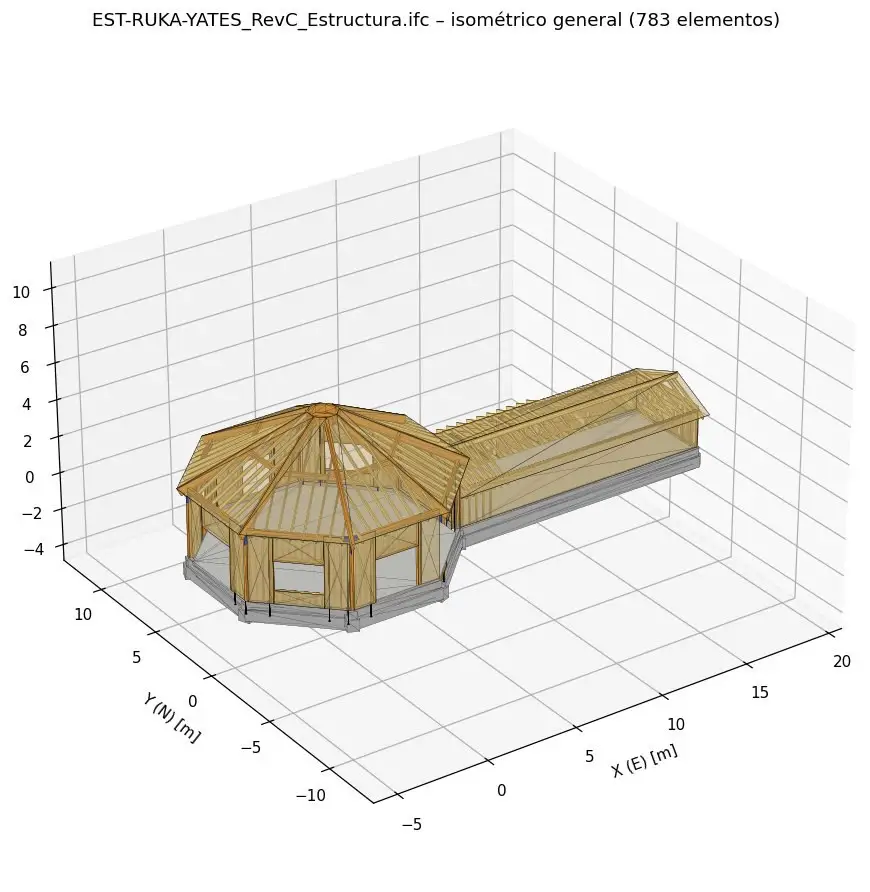
Timber structure for an octagonal meeting building (ruka)
Structural design of an octagonal timber building with a radial roof, coordinated with the architectural model.
Working on something similar?
Tell us the location, type of works and timeline. We will reply with a scope and a proposal.