
Urban flood risk app
An app combining public sources and SWMM modelling to assess the flood risk of an address.
- Client
- In-house development
- Region
- Los Lagos
- Year
- 2026
- Sector
- Real estate and subdivisions · Public sector and rural water
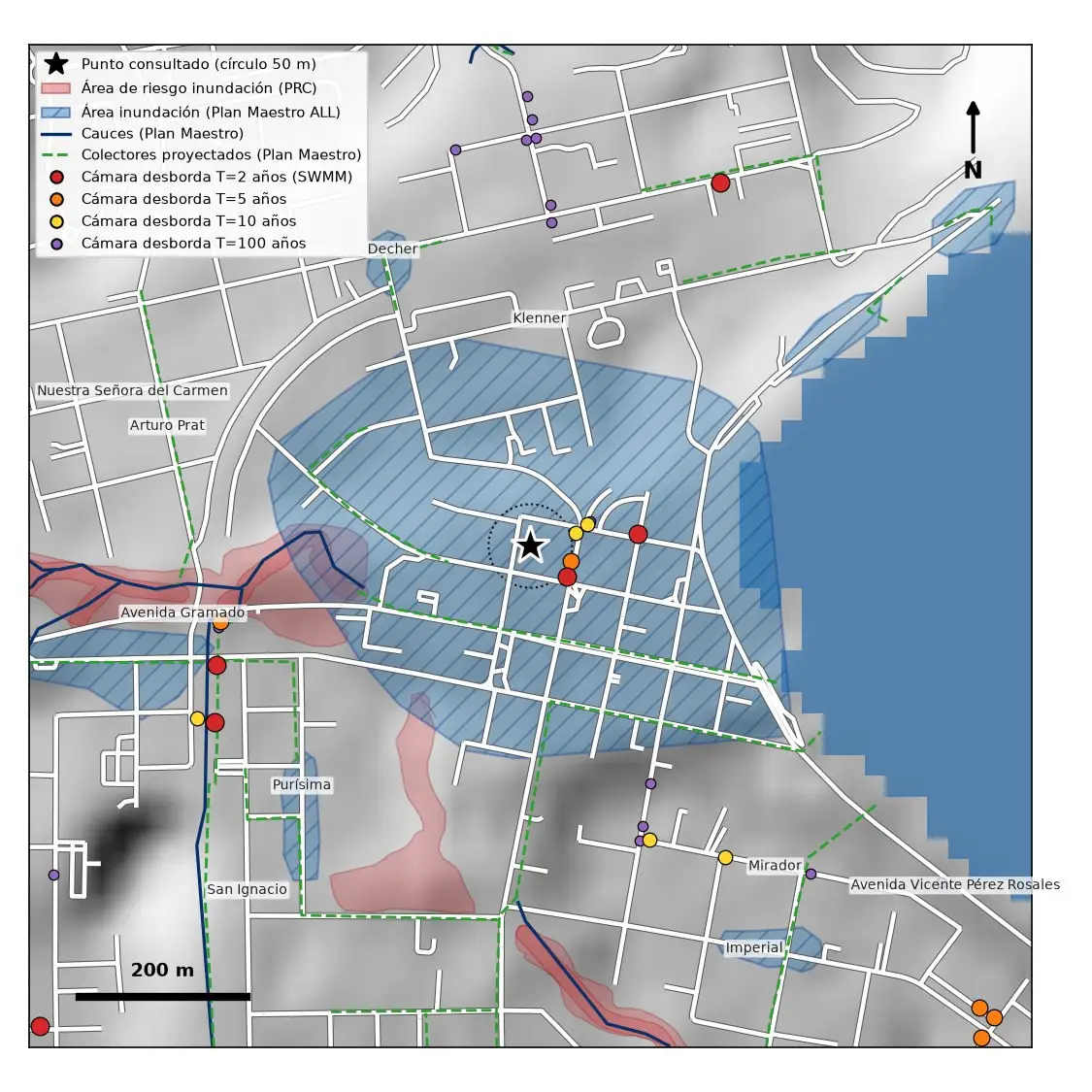
Finding out whether an address is exposed to flooding usually means checking several sources separately.
An in-house app (under development) that combines zoning-plan flood areas, watercourses, stormwater master plan collectors and manholes at overflow risk according to SWMM, and returns a one-page report.
Python, SWMM, QGIS, web app.
Related projects
turbiascaliboro: turbidity forecasting model and alert app
A model that anticipates turbidity events at the water intake and publishes them in an alert app.
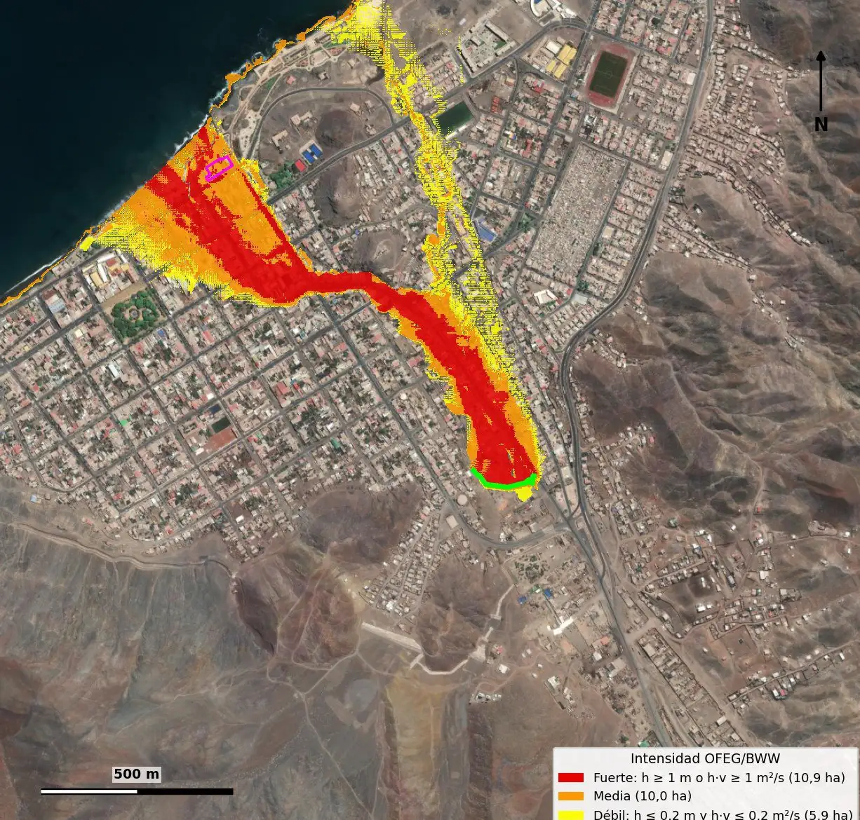
Debris-flow risk study for an urban ravine, Taltal
2D debris-flow modelling to assess the exposure of an urban property.
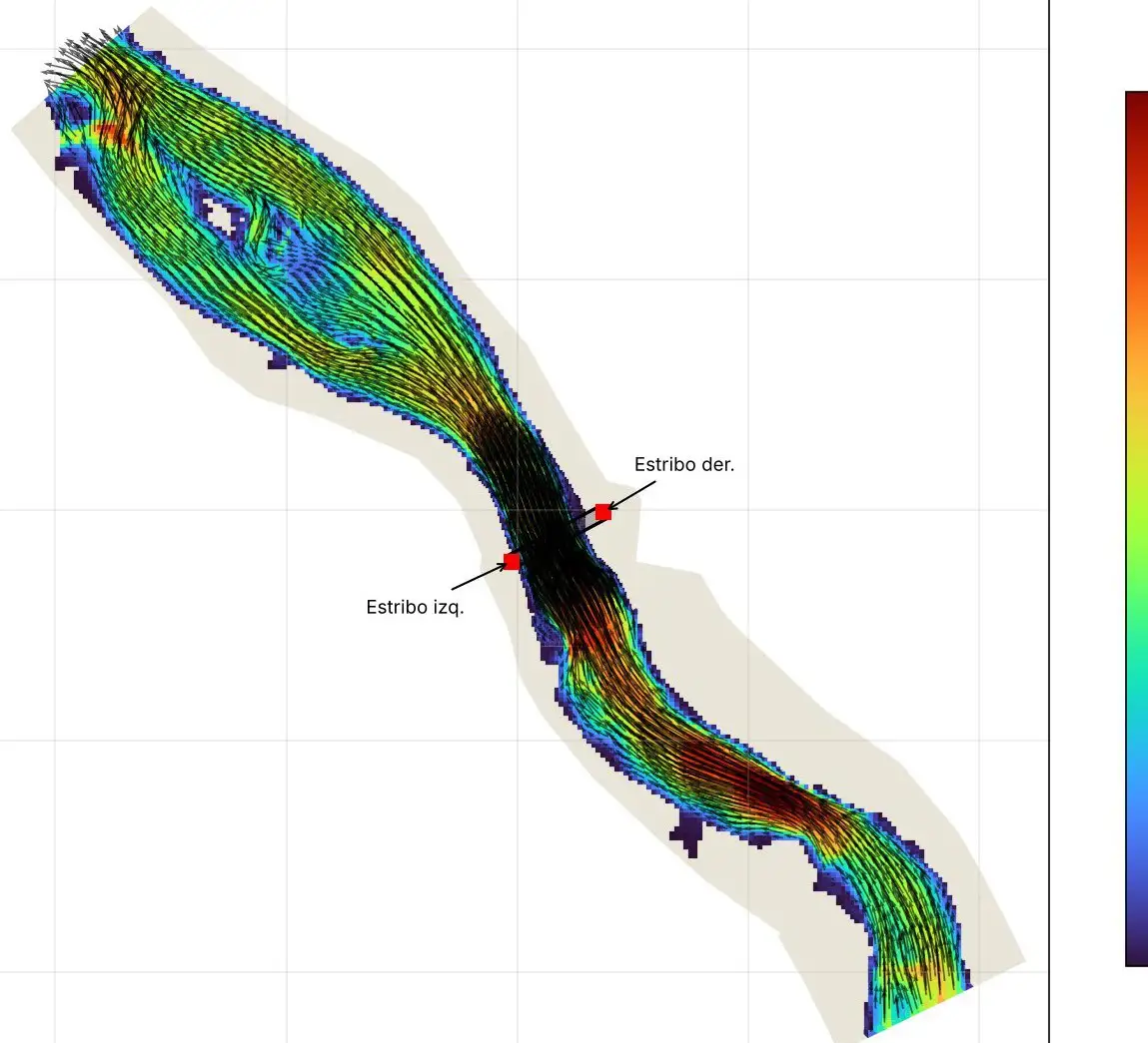
Bridge abutment protection and gravel extraction, Llaquepe river
HEC-RAS 1D and 2D modelling to protect bridge abutments and define a gravel extraction area.
Working on something similar?
Tell us the location, type of works and timeline. We will reply with a scope and a proposal.